• Which the release of FS2020 we see an explosition of activity on the forun and of course we are very happy to see this. But having all questions about FS2020 in one forum becomes a bit messy. So therefore we would like to ask you all to use the following guidelines when posting your questions:

    • Tag FS2020 specific questions with the MSFS2020 tag.
    • Questions about making 3D assets can be posted in the 3D asset design forum. Either post them in the subforum of the modelling tool you use or in the general forum if they are general.
    • Questions about aircraft design can be posted in the Aircraft design forum
    • Questions about airport design can be posted in the FS2020 airport design forum. Once airport development tools have been updated for FS2020 you can post tool speciifc questions in the subforums of those tools as well of course.
    • Questions about terrain design can be posted in the FS2020 terrain design forum.
    • Questions about SimConnect can be posted in the SimConnect forum.

    Any other question that is not specific to an aspect of development or tool can be posted in the General chat forum.

    By following these guidelines we make sure that the forums remain easy to read for everybody and also that the right people can find your post to answer it.

Exclude and texture...How?

Messages
12
Hi Matthew,
I have three questions about FsX KML

First.
Is it normal I need to put manualy the polygones altitude in GE Properties box?
If I don't do that, my river or lake is in altitude 0, and river becomes a canyon!

Second.
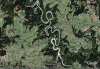
How can I do to have nice fsx water texture for my new river, for the moment I only have fs9 water texture!

Third.
I created a dam's lake but I always have the default river on the lake, how can I do to exclude the river. I have tried to create a bgl file with the same klm file than the lake with Exclude_Hydro_Polygons tag, but it don't works.

Thx for your reply
 
I have another question, I know someone had talk about that in this forum, but sometimes it s diffcult for me to read , english is not my langage.

When I create polygone for river, river is never in the same altitude along his path, how to make polygones follow the terrain altitude? Is it possible or do I need to create river in many Fragments?

Roland

The default rivers are many fragments.

-Doug
 
Thx Matthews,

Can you say me how I can exclude the default river.

First I have created my new river.... no problem I can see it in FSX, but default river is there too, on my new.
Than I have taken the same file kml (the same polygones) and I just change the tag... I have tried with Hydro polygones et Waterpolys, but it doesn't work default river is still there or the Exclude bgl take away my new river!

What s wrong with my method?
 
Use TMFviewer and open the default vector terrain for your area (cvx_____.bgl, look at the SDK documentation on how files are numbered - TMFviewer does help too, in the bottom of the screen you can see dir#____ file#____ - anyway, give it a try.
In TMFviewer find the hydro polygon you intend to exclude. Right-click it and identify it. Find the 'texture' property and read the hex value. In FSXKML or in the SDK docs, find the corresponding tag to the hex value you just read.
For instance, many lakes have texture= BCD5.... This translates to Hydro_Polygons_Generic_Lake_Perennial. That's what you want to exclude.

Be advised you will have to exclude the shorelines separately, for those are different entities within the terrain engine. Locate them in TMFviewer too, it helps to switch off the hydro polys and hydro GPS layers (View menu / Vector Data / ...)

Rafa
 
Raphael,

It s very kind of you to try to explain me how I can do this.
But it seems to me a bit diffcult. I thought I could exclude the default river esayer with FSX Klm just as Matthews say in his tuto, just the same way I creat the new river, in fact it s more complicated than it seems. I have tried lot of tag and diffrent places in fsx scenery library but nothing works...

I cannot speak to the FSX KML mechanism to do this, but you should be able to compile your exclusion(s) AND your new river into ONE bgl file. Then make sure your bgl file is higher in priority than the default scenery.

-Doug
 
I cannot speak to the FSX KML mechanism to do this, but you should be able to compile your exclusion(s) AND your new river into ONE bgl file. Then make sure your bgl file is higher in priority than the default scenery.

-Doug

The problem probably isn't with FSXKML - I have a fairly complex project going on using it right now, with lots of data imported from several sources, generally from shapefiles (some of them ultra-detailed!) and I am using Google Earth to organize everything and then output to KML. The output from FSXKML seems to adhere pretty strictly to the nomenclature and overall layout used in the SDK and its examples.

Roland, could you zip your KML file and attach it here so I could have a look? As I mentioned above, I have a pretty big scenery project using FSXKML and excluding entities isn't a particularly difficult task - apart from the need to draw multiple exclusions, until FSXKML adds support for multiple tags per polygon/line. If I could take a look at what exactly you are trying to exclude and draw maybe I can help you better.

Rafael
 
I have to agree. I did some testing of concept creating an island missing in the default FSX (Kaula in Hawaii state) and found the exclusions work fairly well. If I understand, if the bounding box of an exclusion polygon intersects a lower-priority polygon of its exclusion type, the interescting polygon will be entirely excluded.

scott s.
.
 
Thx Raphael for your help.

Yes I could attached the kml file, but wich one?
In fact I create a river and and the dam's lake.
See attached pic.

I have drew the river and lake on GE. For the exclude bgl, I have tried with the same kml file and I have also drew a simple square on this area. But I realize it s not so simple . When you talked about compilation it s a bit obscur for me I have not enought experience to do that.
I attached a screen shoot of GE with the place where I created the river and the lake.
But I don't want to abuse your time. It s already so kind to reply my post.

Roland
 

Attachments

  • Exclude__WaterPolys.zip
    Exclude__WaterPolys.zip
    7.1 KB · Views: 544
  • GE1.jpg
    GE1.jpg
    97 KB · Views: 656
Thx Raphael for your help.

Yes I could attached the kml file, but wich one?
In fact I create a river and and the dam's lake.
See attached pic.

I have drew the river and lake on GE. For the exclude bgl, I have tried with the same kml file and I have also drew a simple square on this area. But I realize it s not so simple . When you talked about compilation it s a bit obscur for me I have not enought experience to do that.
I attached a screen shoot of GE with the place where I created the river and the lake.
But I don't want to abuse your time. It s already so kind to reply my post.

Roland


Got it. Was simpler than I thought.
Actually, what you intended to exclude is not a hydro polygon, but a stream. A stream is a line, not a polygon.
I took your KML and experimented a bit in GE. I copied and pasted your polygon, tagged one of them with the 'exclude streams' tag and the other with a 'perennial lake' tag. I also cleaned it up a bit.
Notice that you don't need to be that precise when drawing exclusion polys, since it will exclude anything (of the type specified) within a bounding box containing all the pertinent cells. I just used the same poly for simplicity's sake.
The KML file is attached if you want to take a look.

Rafael
 
Last edited:
Thx a lot Raphael,
Yes as you said it was simple... But for me stream lines didn't mean river...
If you didn't say me never I know that...thx
Now I can creat river and exclude this line...

A last thing, can you say me with tag I need to use to exclude building?

Roland
 
Thx a lot Raphael,
Yes as you said it was simple... But for me stream lines didn't mean river...
If you didn't say me never I know that...thx
Now I can creat river and exclude this line...

A last thing, can you say me with tag I need to use to exclude building?

Roland

To exclude a building, you don't use FS_KML. Or at least I have not done it that way to the limit of my knowledge. My understanding is that FS_KML is used to exclude VECTOR DATA, and a building is not vector data.

I excluded a building at KSTL, and I used the Excludes that are documented in the BGL Compiler SDK. (BGLCOMP).
 
I cannot speak to the FSX KML mechanism to do this, but you should be able to compile your exclusion(s) AND your new river into ONE bgl file. Then make sure your bgl file is higher in priority than the default scenery.

-Doug

How do you merge bgl's in FSX? There is no merge tool anymore. I think I remember having one in the old days.
 
Back
Top