• Which the release of FS2020 we see an explosition of activity on the forun and of course we are very happy to see this. But having all questions about FS2020 in one forum becomes a bit messy. So therefore we would like to ask you all to use the following guidelines when posting your questions:

    • Tag FS2020 specific questions with the MSFS2020 tag.
    • Questions about making 3D assets can be posted in the 3D asset design forum. Either post them in the subforum of the modelling tool you use or in the general forum if they are general.
    • Questions about aircraft design can be posted in the Aircraft design forum
    • Questions about airport design can be posted in the FS2020 airport design forum. Once airport development tools have been updated for FS2020 you can post tool speciifc questions in the subforums of those tools as well of course.
    • Questions about terrain design can be posted in the FS2020 terrain design forum.
    • Questions about SimConnect can be posted in the SimConnect forum.

    Any other question that is not specific to an aspect of development or tool can be posted in the General chat forum.

    By following these guidelines we make sure that the forums remain easy to read for everybody and also that the right people can find your post to answer it.

Tutorial autogen workflow

arno

Administrator
Staff member
FSDevConf team
Resource contributor
Messages
33,995
Country
netherlands
Hi all,

I have made a new video tutorial where I explain the typical workflow I use to create autogen. I hope you find it useful.

PS. At the moment I am still uploading the file (it is rather big), so the video should be online in about 1 hour or so.

[youtube]09RrJMWQ7cI[/youtube]
 
Hi Arno,
based on your Workflow Video, I'm trying to get my scenery filled with autogen houses. I almost copied your script and put my German comments in.

Code:
# Autogen Szenerie Erstellung
# Westercelle Celle Süd
#
IMPORTOSM|Z:\Arbeitsdateien\celle-sued.osm|*|highway;landuse;building
#
EXPORTSHP|*|Celle-sued
#
SPLITGRID|AGN|building=*
#
# Attribute erstellen um Gebäudetypen festzulegen
# 1 = rechteckig
# 2 = nahezu rechtwinklig (basierend auf Seitenverhältnis)
# 3 = gerade geformt (viele parallele Seiten)
# 4 = konvexe Polygone
# 5 = konkave Polygone
#
ADDATTRIBUTE|FTYPE=POLYGON;building=*;FNUMVERT=4;FNUMPERPANG=4|BUILDTYPE|1|1
ADDATTRIBUTE|BUILDTYPE!1;FTYPE=POLYGON;building=*;FAREARAT>0.70|BUILDTYPE|2|1
ADDATTRIBUTE|BUILDTYPE!1;BUILDTYPE!2;FTYPE=POLYGON;building=*;FNUMPERPANG>3;FNUMNOTPAR<2;FNUMVERT<10|BUILDTYPE|3|1
ADDATTRIBUTE|BUILDTYPE!1;BUILDTYPE!2;BUILDTYPE!3;FTYPE=POLYGON;building=*;FCONVEX=1|BUILDTYPE|4|1
ADDATTRIBUTE|BUILDTYPE!1;BUILDTYPE!2;BUILDTYPE!3;BUILDTYPE!4;FTYPE=POLYGON;building=*|BUILDTYPE|5|1
#
# Attribut hinzufügen um die Gebäudekategorie
# basieren auf dem landuse Polygon zu festzulegen
# 1 = ländlich
# 2 = Wohngebiet
# 3 = Industrie
#
ADDATTRIBUTE|FTYPE=POLYGON;building=*|BUILDCAT|1|1
ADDATTRIBUTEIFINSIDE|FTYPE=POLYGON;building=*|FTYPE=POLYGON;landuse=residential|BUILDCAT|2|1
ADDATTRIBUTEIFINSIDE|FTYPE=POLYGON;building=*|FTYPE=POLYGON;landuse=industrial|BUILDCAT|3|1
#
# Neue Eigenschaften erstellen (komplexere Polygone in einzelne Rechecke teilen)
REPLACEPOLYGONBYBUILDINGRECTANGLES|BUILDTYPE=3
#
# Punktobjekte an Linien setzen (hier Laternen an der Straße)
PLACEPOINTSALONGLINE|FTYPE=LINE;highway=secondary|50|5|type|laterne|hdg
#
# Eigenschaften
#
# Geschosshöhen (4 Werte zwischen 0.0 und 1.0 wobei der erste Wert die prozentuale anzahl von 1-2 geschossigen Häusern
# der 2. 3-5, der 3. 6-8 und der 4. 9-12 Geschosse bedeutet
SETAGNBUILDINGHEIGHT|1.0;0.0;0.0;0.0
# hier hat Arno Benutzertexturen eingebunden, da weiß ich nicht genau was ich machen muss
#
# Vegetation
CREATEAGNPOLYVEG|FTYPE=POLYGON;landuse=forest|{c9dc45ae-f240-42a9-a137-b7617452a308}
#
# Gebäude
CREATEAGNGENBUILD|BUILDCAT=1;BUILDTYPE<3|{420b3b5d-78cc-4885-9483-06ff982e21bd}
CREATEAGNGENBUILD|BUILDCAT=2;BUILDTYPE<3;FWIDTH<15|{5ae04eb6-934c-4f63-bb48-5e7dee601212}|MAXRATIO=2
CREATEAGNGENBUILD|BUILDCAT=2;BUILDTYPE<3;FWIDTH>15|{311de8c7-e596-4e28-a94d-da09d0252ce4}
CREATEAGNGENBUILD|BUILDCAT=3;BUILDTYPE<3;FWIDTH>20|{4eb68be7-2f1f-4cd2-920e-becfa2d8c888}
#
# Library Objekte
CREATEAGNLIBOBJ|FTYPE=POINT;type=laterne|{0017a263-464f-14fd-f77f-2996fed44864}|hdg|6;6
#
# AGN File speichern
WRITEAGNFILES|FSX|Z:\Arbeitsdateien\Celle Rest\AGN Files

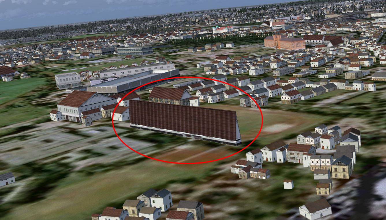
Your tool is great but I got some weird buildings and I don't know what I did wrong.

celle-beta.jpg


At 12:40 in the Video, you put a custom texture in. Can you explain that a little more? The default agn houses do not look very realistic for our region.

Thanks for helping!

Carsten
 
Hi,

I guess you have a long and narrow footprint, that can give such houses. I added the MAXRATIO argumment to the residential houses to split such long buildings into a couple of smaller ones. But maybe this one is in the rural category. You could try to add it there as well.

The sdk has quite good documentation on how to make your own autogen texture. After that you just assign it to the agn tiles.
 
Hi,
thanks for the quick answer and you were right :)
I'll look into the SDK for the textures.
Carsten
 
Hi Arno,
while working on my scenery, more and more questions coming up. :confused:

Here's one:
When I import an *.osm File in ScenProc which was a rectangular XML export from the Openstreetmap Website, and create *.agn files with it. And then do another Openstreetmap export defining a rectangle next to the last one, some of the *.agn files ScenProc creates are of the same filename as before and I loose the buildings I first created.

Do the *.agn files have a given tile-size I have to match the Openstreetmap export to?

I hope my English is understandable.

Thx
Carsten
 
Hi Carsten,

Your English is fine.

The autogen LOD tiles are 0.0146484375 by 0.010986328125 degrees in size. So that is the size you would have to take into account.

I have it on my wishlist to add a feature that can merge new objects with an existing AGN file. So in that case the second file could add to the AGN file, instead of overwrite it.
 
Hi Carsten,
May be you can use my tool: AGN Merge Tool :rolleyes:
First you just need to create your 2 Area with scenproc in 2 different "texture" folder to get the all the AGN files. After that my tool CAN merge the common AGN files in one.

Another possibility: before creating your Area, use a grid in Qgis with an AGN step(with Arno values) and snap it to the FSX AGN coordinate.
 
Great idea !:D but it would be more simple I do a quick translation... Must wait few day. :o
 
That's an even better idea.
But I get an unhandled exception error when I try to use your tool.
I think it's better to start a new thread regarding that problem, because it drives this thread to far off topic.

I'll post the message in "Terrain Design -Autogen".

Carsten
 
Last edited:
Hi Arno,

next question.:D

The processing step:
CREATEAGNLIBOBJ
Does it use the autogen.bgl in ...\Global\scenery ?

And did I understand it right that I can use your Library Creator XML tool to make my own library i.e. streets.bgl, filled with my streets and street utilities,
put it in ...\Global\scenery and then add this as an additional class to the default.XML file, then scenProc includes them too?

Carsten
 
Last edited:
That is correct. In scenproc you only reference the guid of the class in the default.xml though.

Send from my phone using Tapatalk, so excuse the short sentences and possible typos
 
Hi,

that sounds great and I'm a big step forward.
But...
The development release I downloaded today give me no autogen houses anymore. The agn files end now with "an0" and although the progress info shows everything okay, there are is no autogen scenery :(.
I'll change back to the earlier release to compare the results.
Carsten
 
Quick Info,

I switched back to the development release downloaded 4. Jan.
(the file endings *an.agn)
and the scenery is showing.

Another issue: I noticed that die file creation date of the agn files is about 1:10h ahead the actual system time.

Carsten
 
Hi Carsten,

Let me check what is going wrong with the development release.

About the time, scenProc only writes the files. It does not set any time on them. So that sounds like a OS problem more.
 
Hi,

The filenames was a bug indeed. I have fixed that now.
 
Hello,

I've had some success I like to share with you: :)

ethc_streettest.jpg


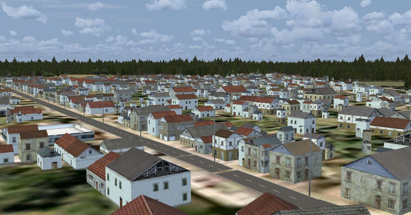
Not perfect yet, some gaps in it, but it is just a test. The street objects are placed by Openstreetmap line data.

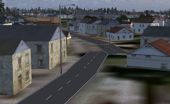
One problem are the curves, maybe experimenting with the filter FMINSIDE can help here?

Carsten
 
Last edited:
Hi,

Looks nice. How is the performance when you put the roads down as MDL models?

Not sure if the FMINSIDE would help for corners. That attribute is the shortest segment in a line. It might be a bug in the place objects along line step, I noticed that the spacing is not always as regular as expected.
 
Hi Arno,

Performance is quite good, the street object has not so many drawcalls.
I have to get used to the latest Model Converter X to optimize my models further. The earlier version I used must be very obsolete by now.

I noticed that the spacing is not always as regular as expected.

Yes, same thing with the lamps. The lamps are spaced 50 now, but it doesn't look like 50 meters. If I use 25 meters it gets even more out of ... space.

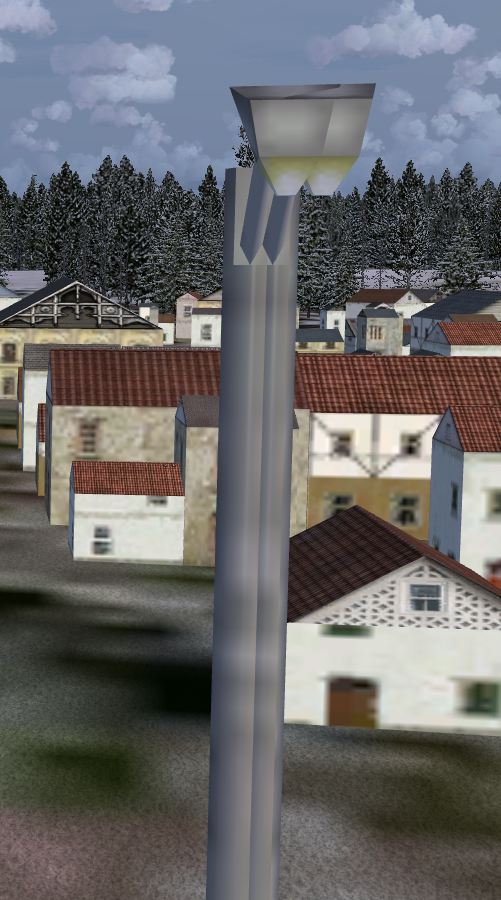
Looking closely at the lamps show them double in some way.

doublelamp.jpg


The FMINSIDE idea was to detect where curves are, but only getting the length of the shortest segment won’t help, I guess.

curve.jpg


Do you know what happens with overlapping models?

Carsten
 
Last edited:
Another thing...

is there any bug report thread for your tools, Arno?
I.e. ModelconverterX v1.2 runs fine, version 1.4 don't.

I like to give you some feedback to debug, how and where is the best way you like me/us to do it?

Carsten
 
Back
Top