• Which the release of FS2020 we see an explosition of activity on the forun and of course we are very happy to see this. But having all questions about FS2020 in one forum becomes a bit messy. So therefore we would like to ask you all to use the following guidelines when posting your questions:

    • Tag FS2020 specific questions with the MSFS2020 tag.
    • Questions about making 3D assets can be posted in the 3D asset design forum. Either post them in the subforum of the modelling tool you use or in the general forum if they are general.
    • Questions about aircraft design can be posted in the Aircraft design forum
    • Questions about airport design can be posted in the FS2020 airport design forum. Once airport development tools have been updated for FS2020 you can post tool speciifc questions in the subforums of those tools as well of course.
    • Questions about terrain design can be posted in the FS2020 terrain design forum.
    • Questions about SimConnect can be posted in the SimConnect forum.

    Any other question that is not specific to an aspect of development or tool can be posted in the General chat forum.

    By following these guidelines we make sure that the forums remain easy to read for everybody and also that the right people can find your post to answer it.

P3D v4 Birds air Route Puttgarden<->Rødbyhavn with EKMB Maribo Airport

Now the first two Scandline ferries ("Germany" and "Schleswig-Holstein") have been completed on the "Vogelfluglinie" (Birds fly route). Here is a short video of the ferry "Germany" in Rodbyhavn.


Please post a screenshot... I am curious to see the progress but here in China Youtube only plays with VPN and my VPN is on strike....
 
Hello Henrik,

I will take some screenshots tonight when I come home. Unfortunately, I can't control the sim from the office ;)
 
Hello Henrik,

here ar some pics of the ships:

First your "Samka"
Samka.JPG


your "Volgo Balt":
VolgoBalt.JPG


and the new Scandline Ferries:
Scandline_Ferry1.JPG


Scandline_Ferry2.JPG


Scandline_Ferry3.JPG
 
Hello Henrik,

here ar some pics of the ships:

First your "Samka"
Samka.JPG


your "Volgo Balt":
VolgoBalt.JPG


and the new Scandline Ferries:
Scandline_Ferry1.JPG


Scandline_Ferry2.JPG


Scandline_Ferry3.JPG
Hi Manfred,
Looks great. it truely gives the sensation of Rødbyhavn. I liked when we had to take the ferry on all major trips in Denmark. Now there are too many bridges. Rødbyhavn is one of the few remaining important ferryports.
 
Hi Henrik
I agree with you: there are too many bridges.
I prefer the ferries, too. They give you the opportunity to slow down a little bit and enjoy the little cruise. Let's hope that the construction of the tunnel between Puttgarden and Rodbyhavn will take a very long time. It would be a shame if the "mini crusaders" disappeared.
 
"Mini crusaders" is a bit of an unfortunate translation. :laughing:
("Mini cruise ships" would be more appropriate.)

Can't agree on the matter of tunnels and bridges. The trip across the Öresund is much more interesting because of that marvelous bridge.
 
Well, in German we call a cruise ship also "Crusader", although the Crusader is more like a passenger.
We call a cargo ship also "freighter". ;)

Whether bridge or ship, everyone has his preferences. But since I usually sit behind the steering wheel, I don't get much of the view from there. On a ferry I can relax and enjoy the view. You can also have a cup of coffee or something to eat in peace and quiet
donotdisturb.gif
:D
 
After Rødbyhavn is finished, I am now working at the port of Puttgarden on the island of Fehmarn. The first structures and buildings are already in place. In addition, Puttgarden will also be equipped with an aerial photograph. At the moment I am still using an aerial photo with a lower resolution, which makes it easier for me to place the objects. But I am currently trying to get a license for a ground image with a resolution of 20 cm per pixel. Christian Bahr (Bahrometrix. de) has agreed to prepare this soil image with GIS software and equip it with autogen.

Here some first pictures of Puttgarden:

Putt1.JPG


Putt2.JPG


Putt3.JPG
 
The originally planned release date of April 2018 for the scenery has died.

Since I have now decided to equip Rodbyhavn with an aerial photo I can start again from the beginning. Dozens of new models (buildings, bridges, etc.) have to be created, others have to be changed and/or relocated. In addition, there are hundreds of autogenous buildings that I have to set by hand (lack of a license for GIS images) as well as the entire vegetation (several thousand trees and bushes). Not to forget the retouching of the floor pictures and their adaptation to the seasons.

It's going to take a lot of work, but I think it's really worth it. That's why I don't want to fix a release date. When it's done, it's finished - but I'll keep you up to date here.

Here a preview of Rodbyhavn with aerial photo:

Rodby_bodenbild.JPG
More work, but will be fantastic - maybe you should consider an option where users do not install the photo but just the scenery elements unless your photo fits with Vidan Design.
 
Hello Henrik,

there are two files for the photo ground one for Rodbyhavn and one for Puttgarden. So Vidan Design customers can deactivate Rodbyhaven but leave Puttgarden activated. The aerial photos are otherwise adapted to ORBX Global Basic/OpenLC Europe/FTX Vector and ORBX Germany North. I hope this matches to most configurations.
Sounds perfect :)
 
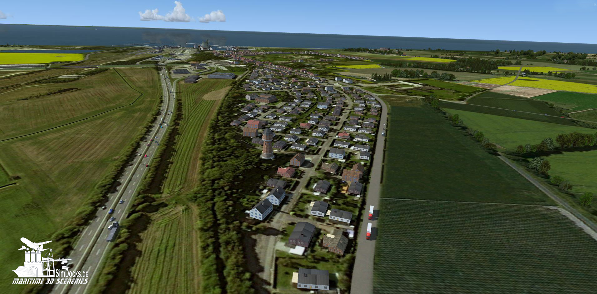
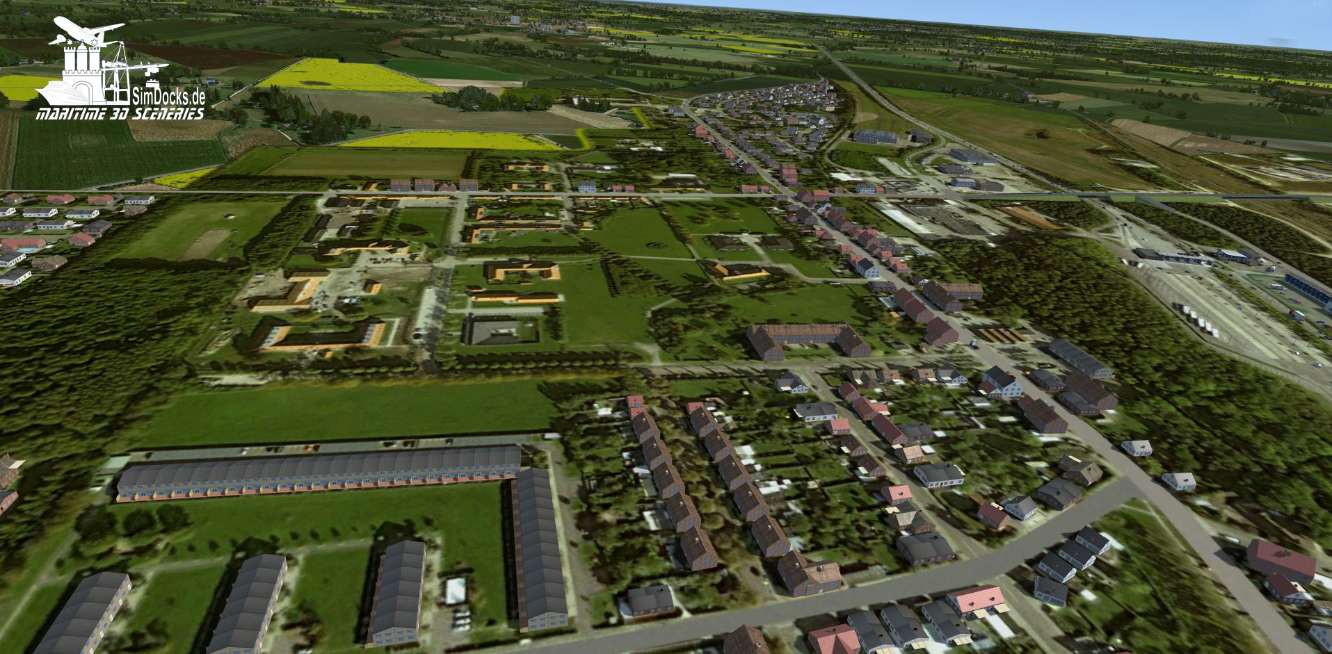
Here are the first pictures of "new" Rodbyhaven (here still without any 3D vegetation):
The floor pictures for the different seasons are finished except for a few small adjustments and in the meantime I have already built and placed a lot of buildings.
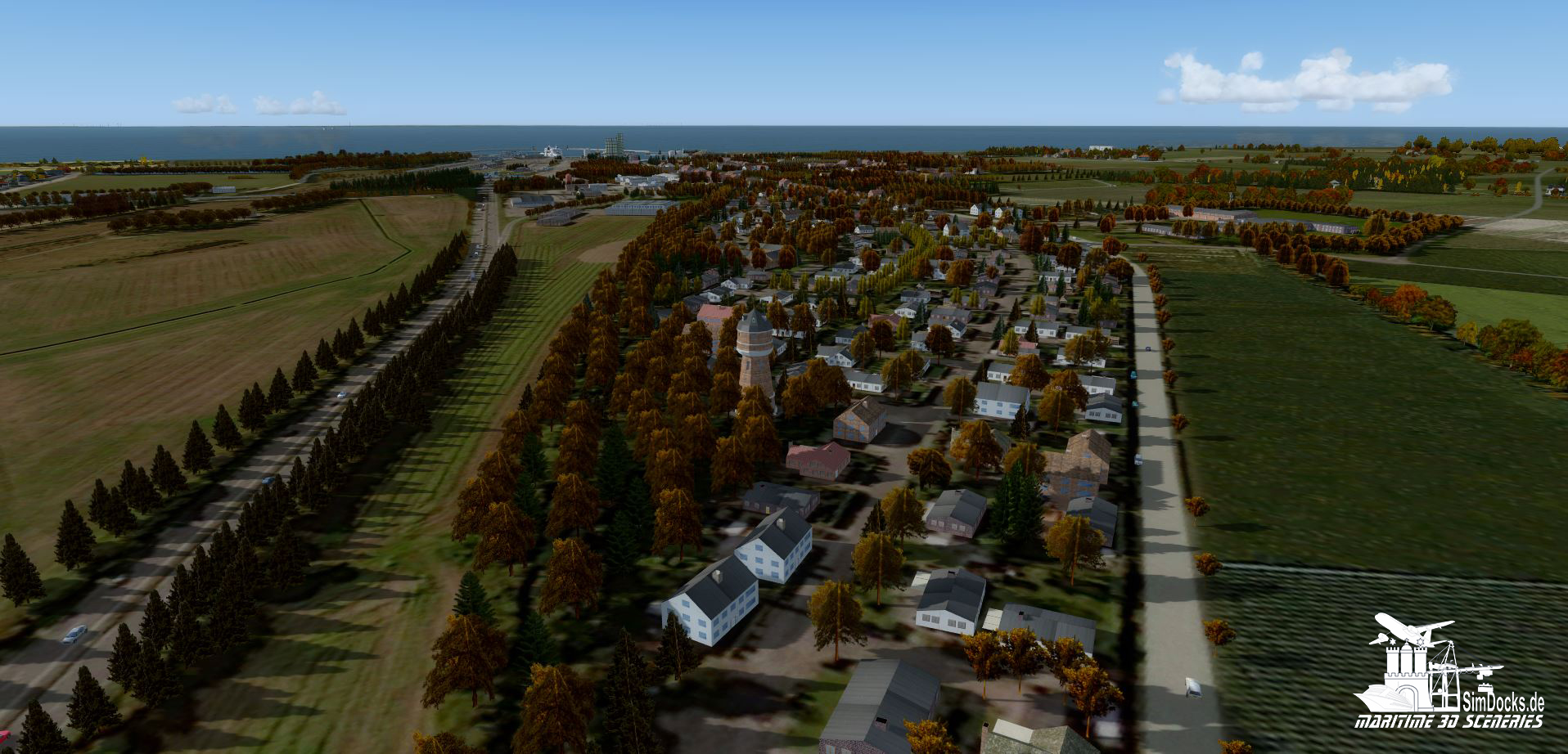
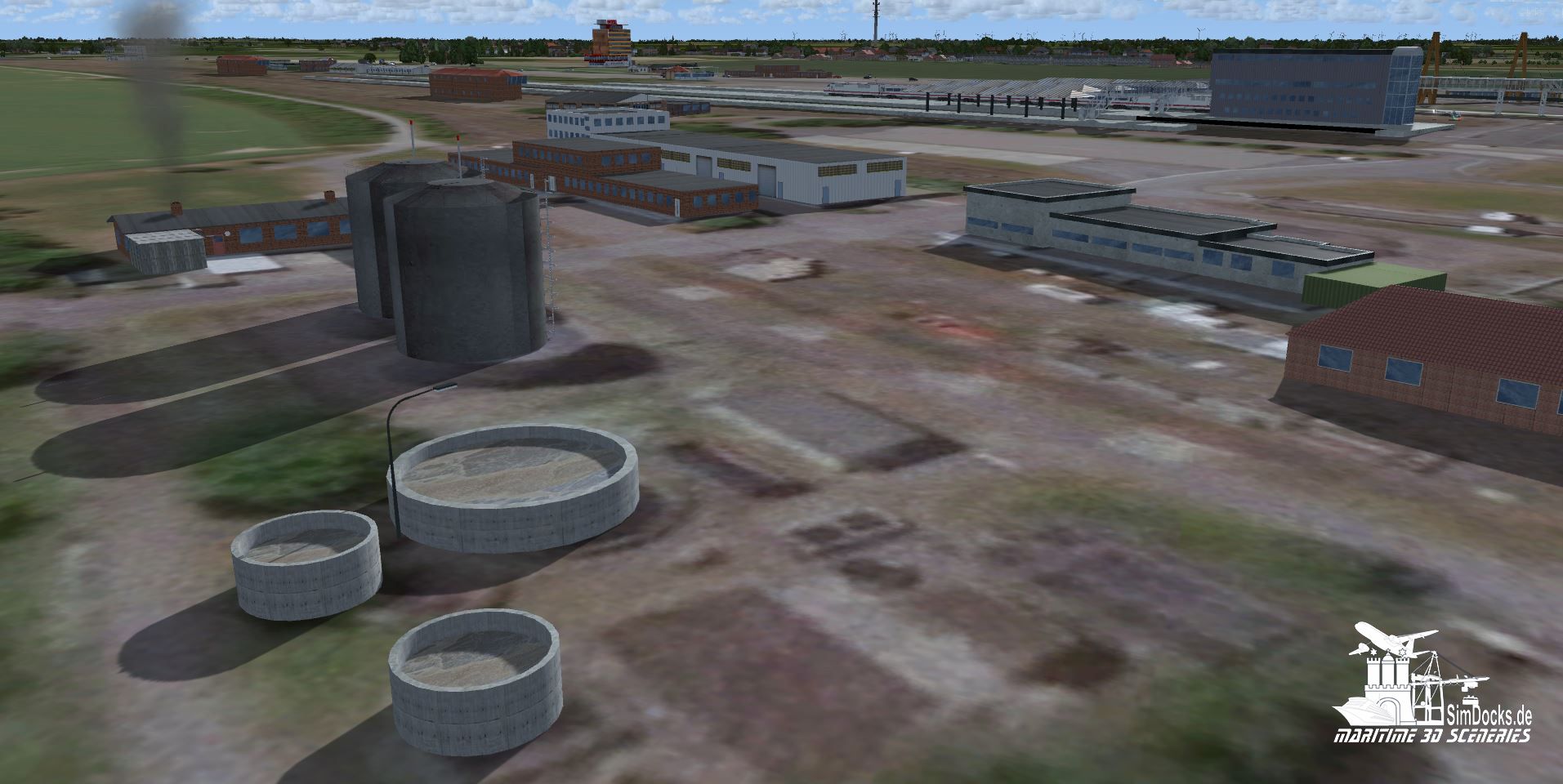
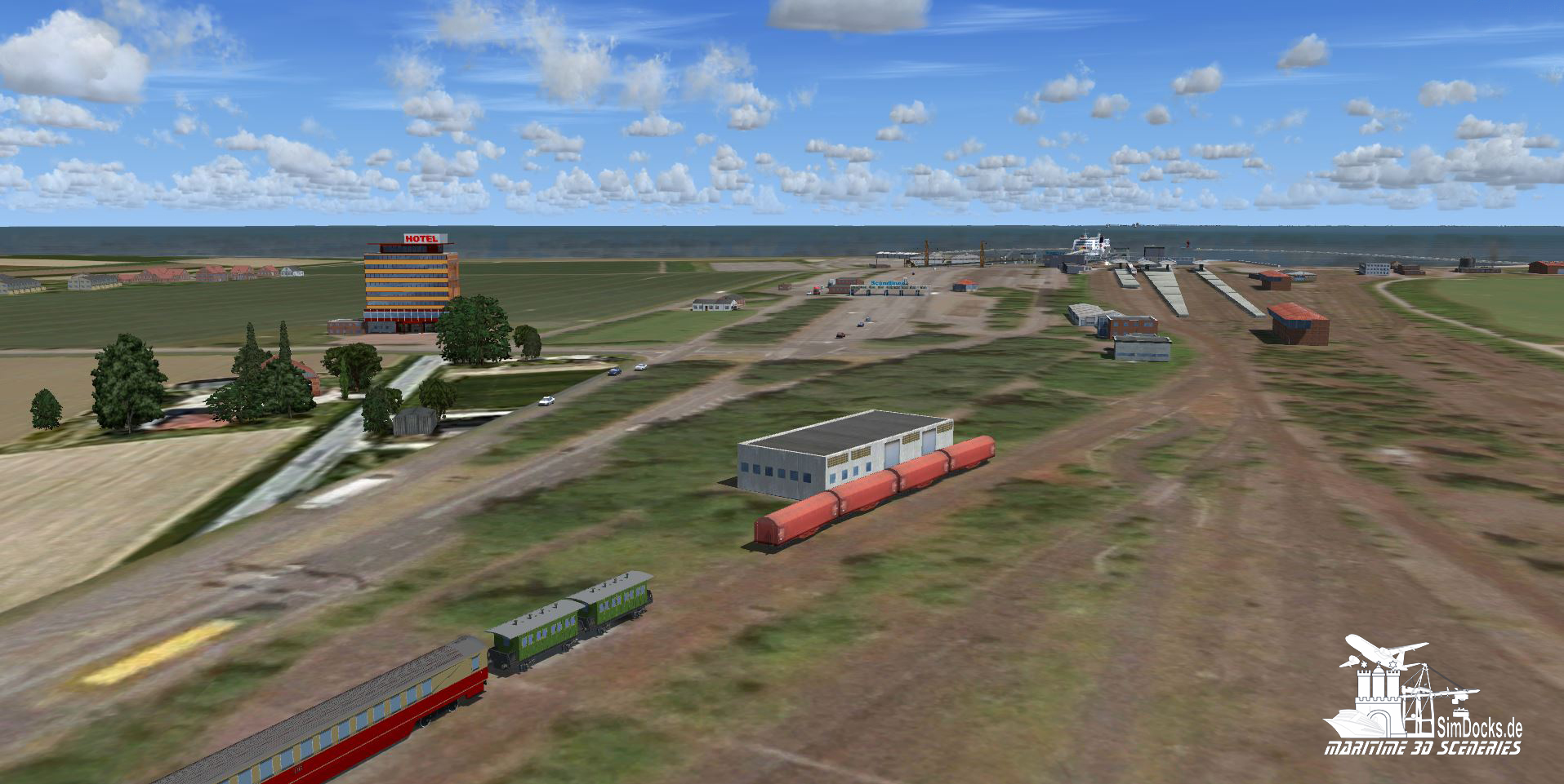
Now every building and every carport stands where it belongs according to the ground picture. I have also made sure that the buildings are built in the same way as they look in reality from above. So I was able to insert buildings with a very high recognition value. See more in the pictures.

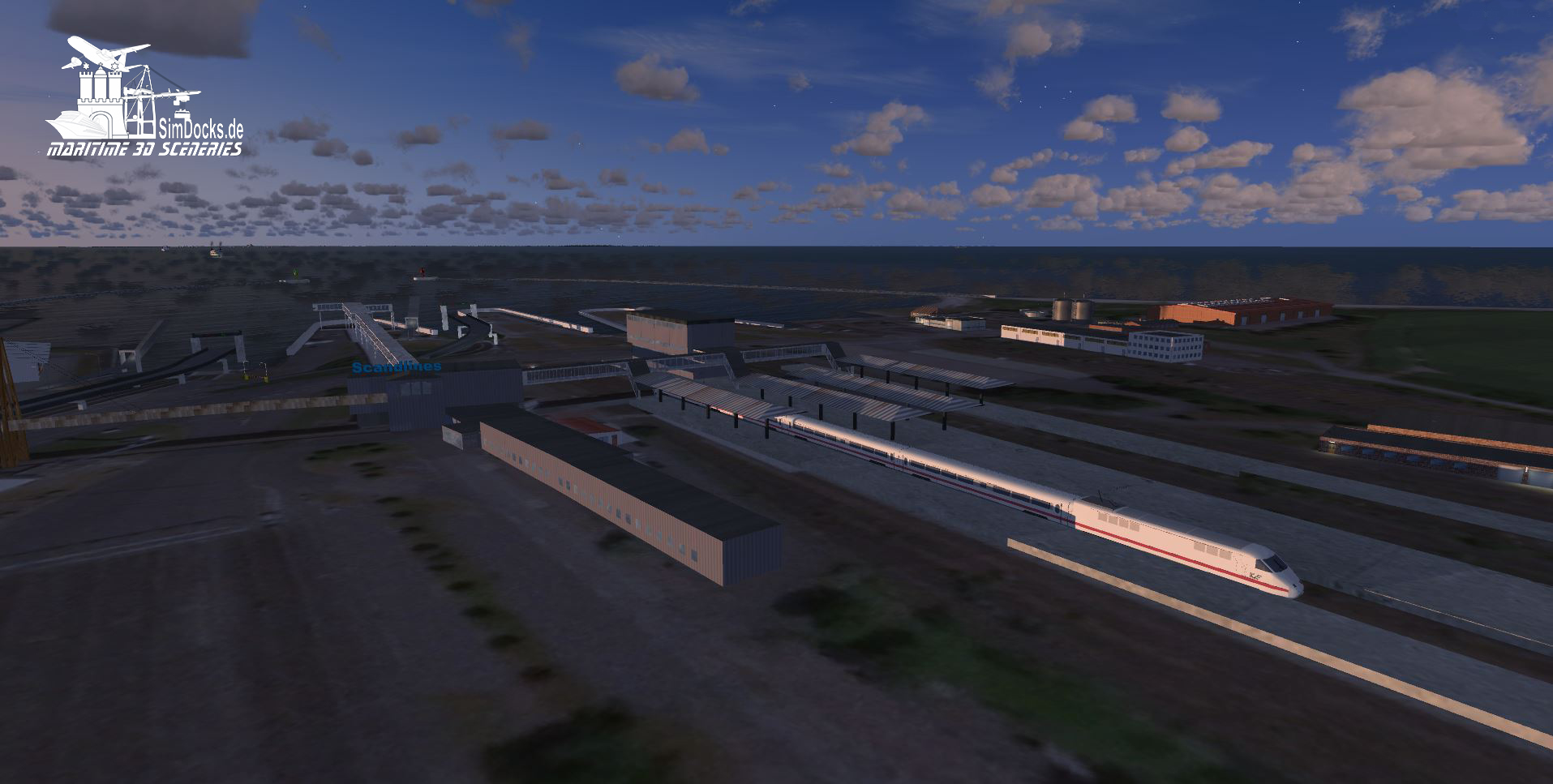
Here an overview from north to south:
Rodby_Bodenbild-1.JPG


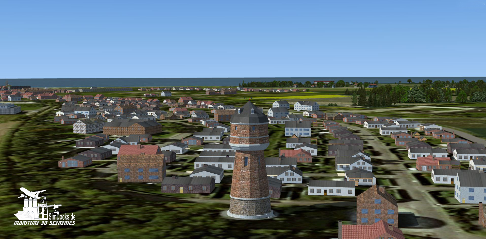
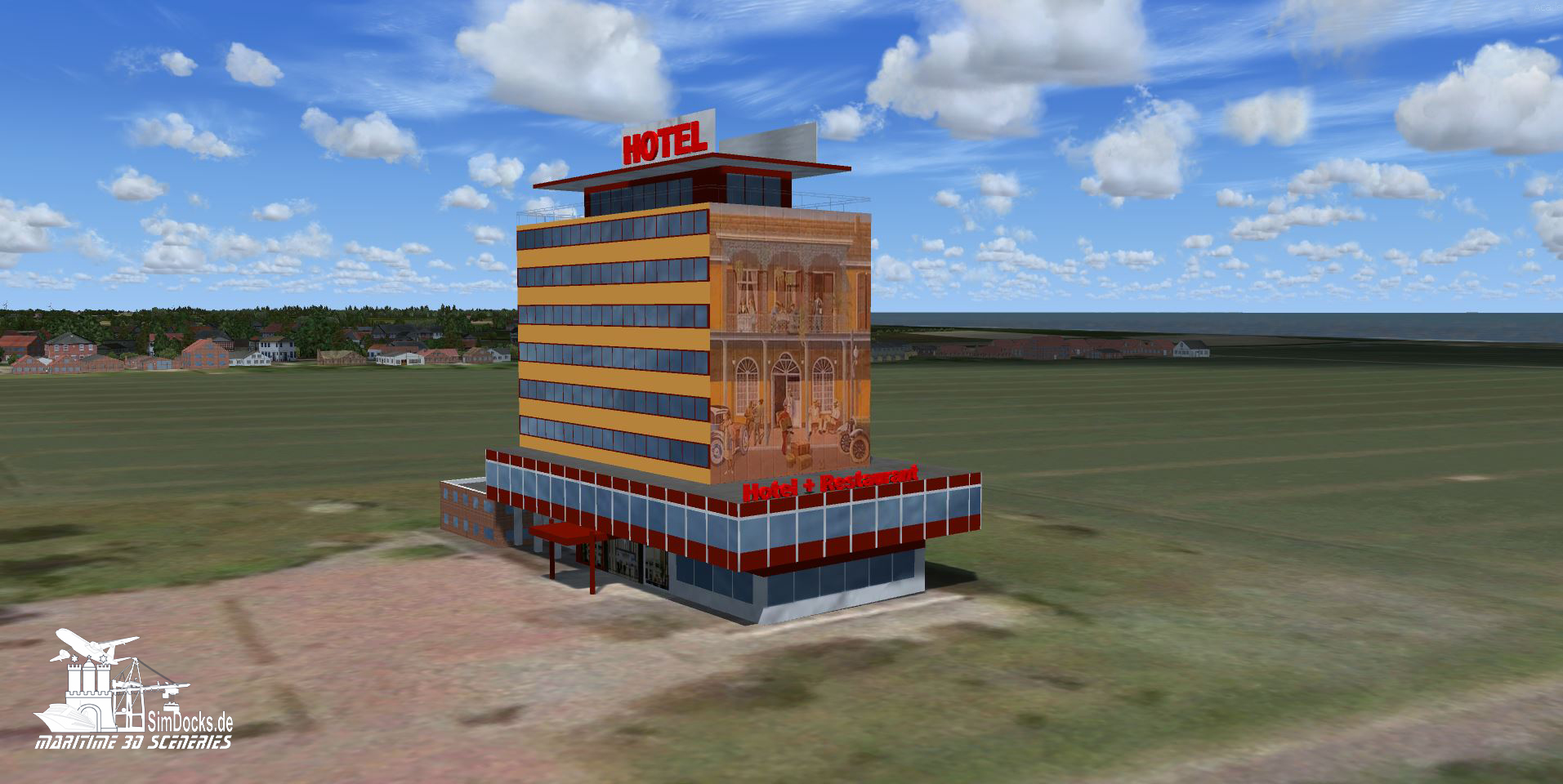
Special buildings with recognition value:
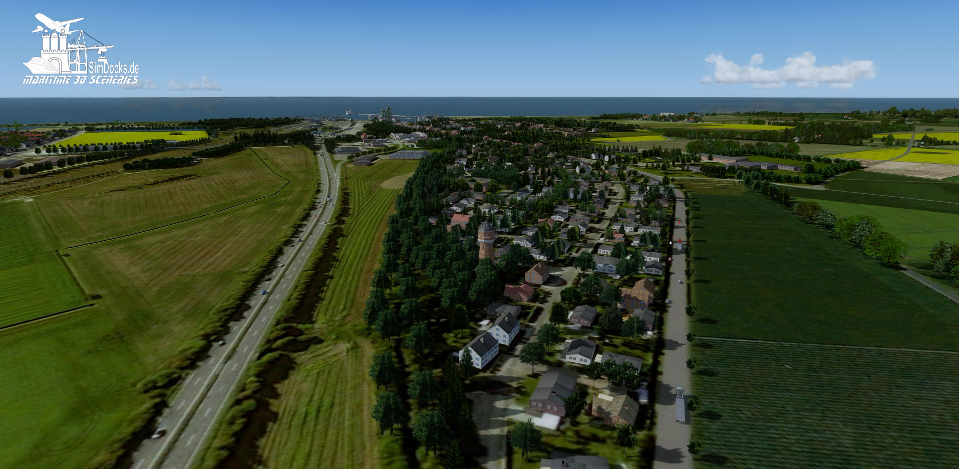
The water tower of Rodbyhaven. I don't know if it really looks like THIS, but according to GE it's going to work.

Rodby_Bodenbild-Wasserturm.JPG


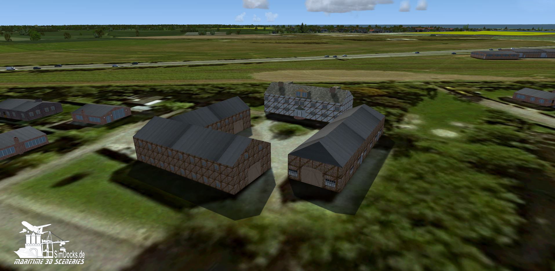
One of the big farms (manner) in Rodbyhaven. Here too - as with all buildings - I made sure that the buildings coincide with the ground picture.
Rodby_Bodenbild-Gutshof.JPG


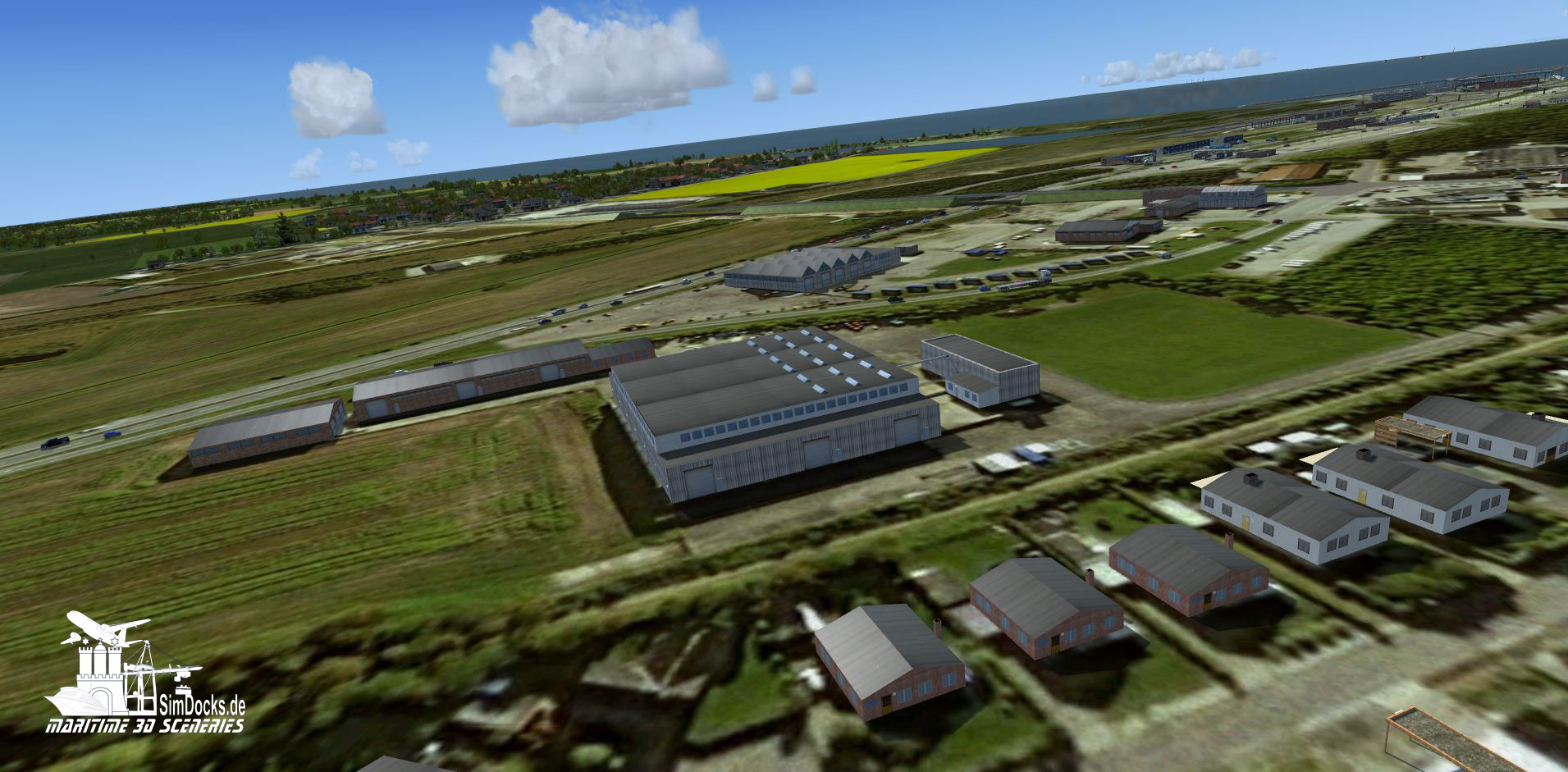
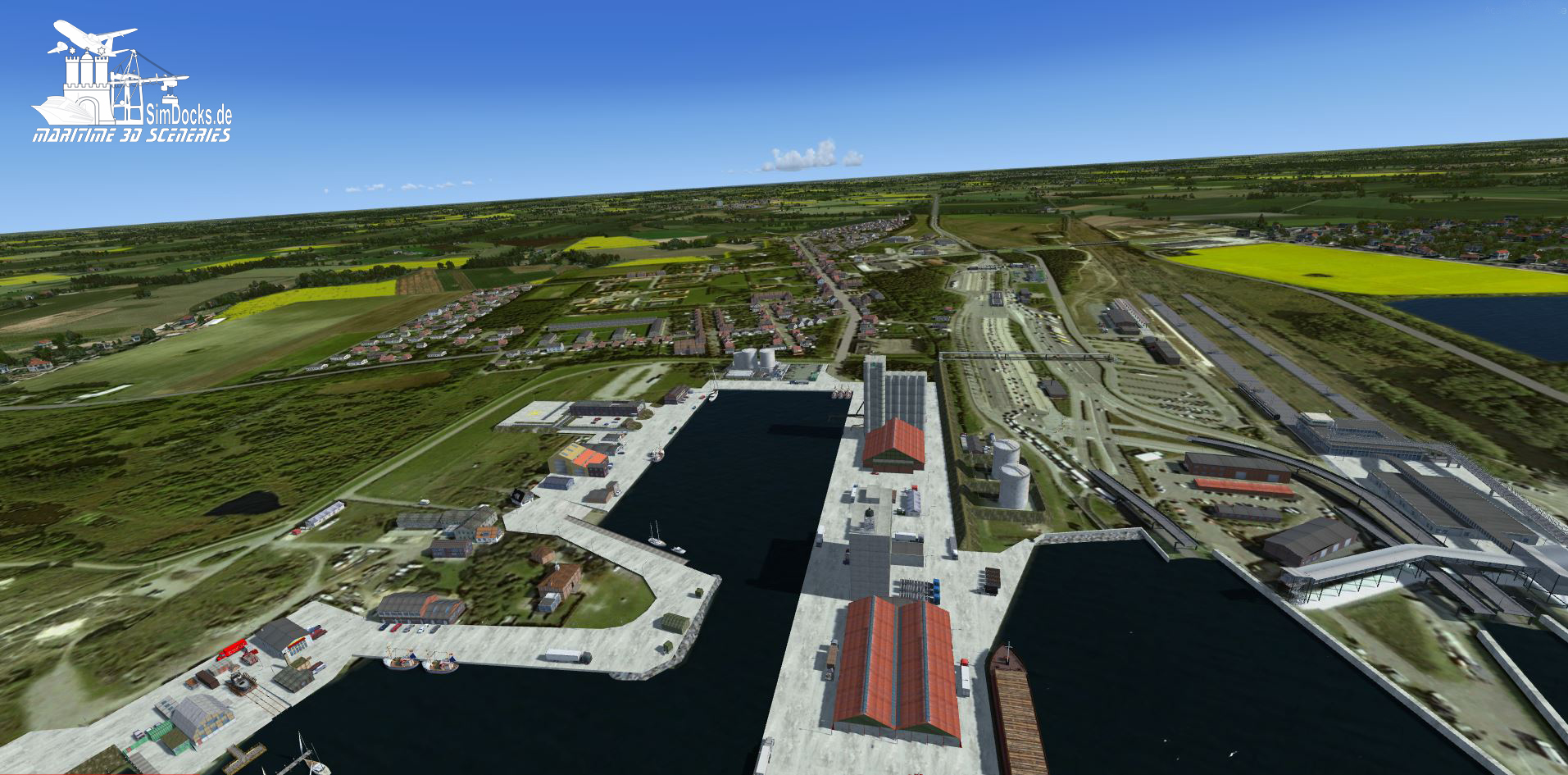
Here are some of the industrial buildings (however, there are still some missing which still have to be built)
Rodby_Bodenbild-Industrie.JPG


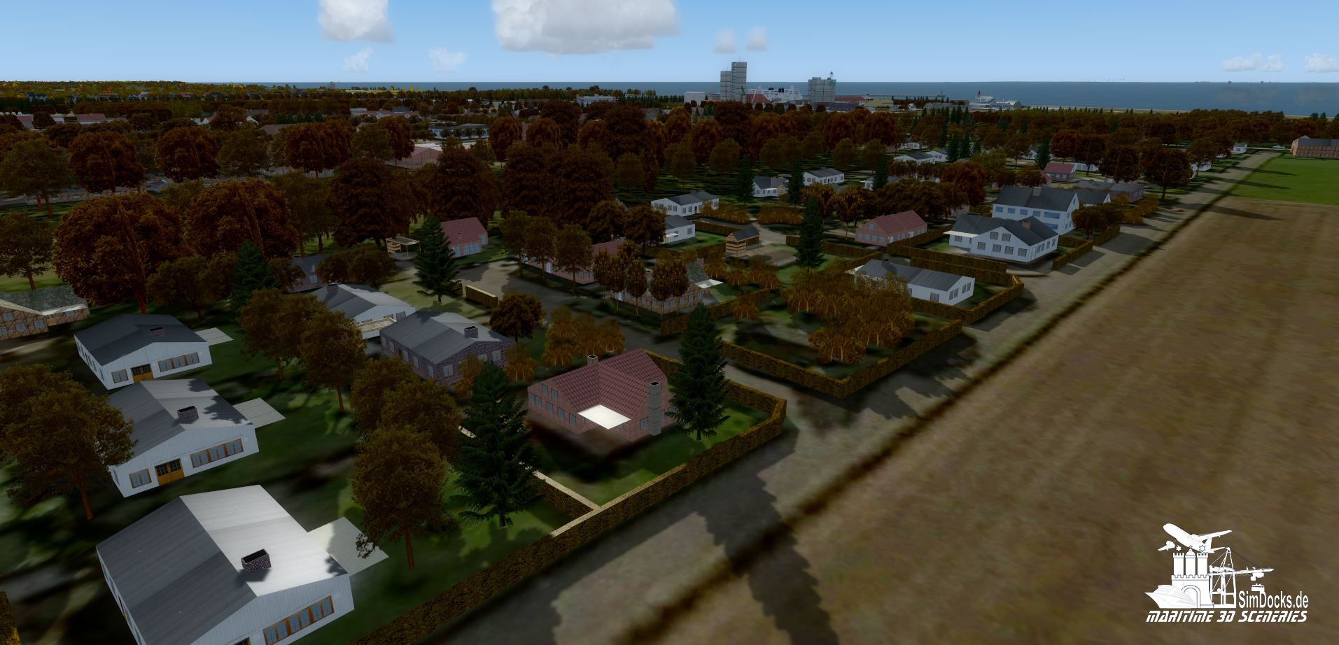
The Rodbyhavn Holiday Center "Syltholmsparken".

Rodby_Bodenbild-FerieCenter.JPG


It was a lot of work in the last few days to build, texturize and set all the buildings by hand. But as this picture shows, there are still a lot of special buildings that I have to create.

Rodby_Bodenbild-fehlende_Gebaude.JPG


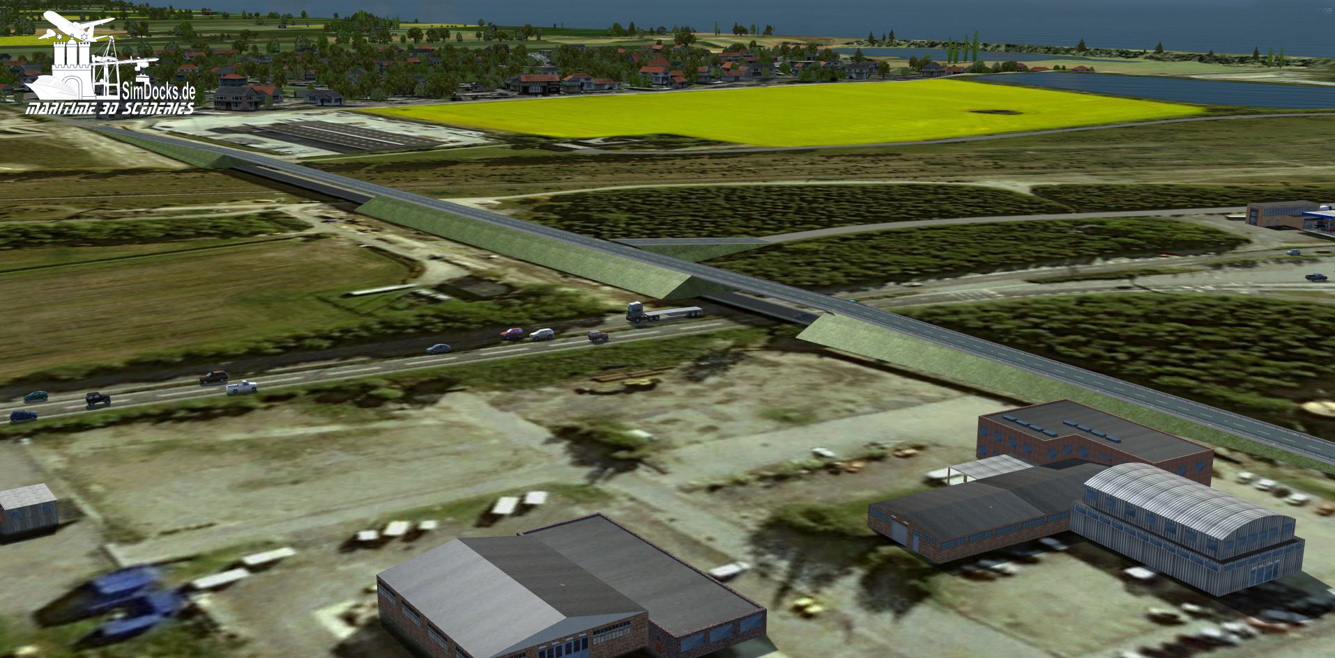
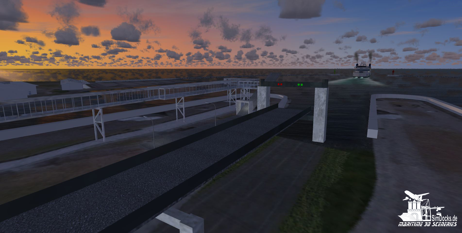
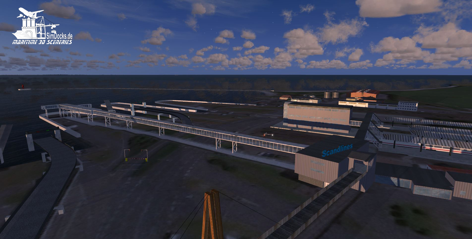
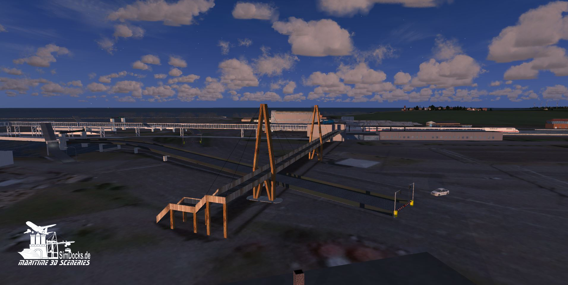
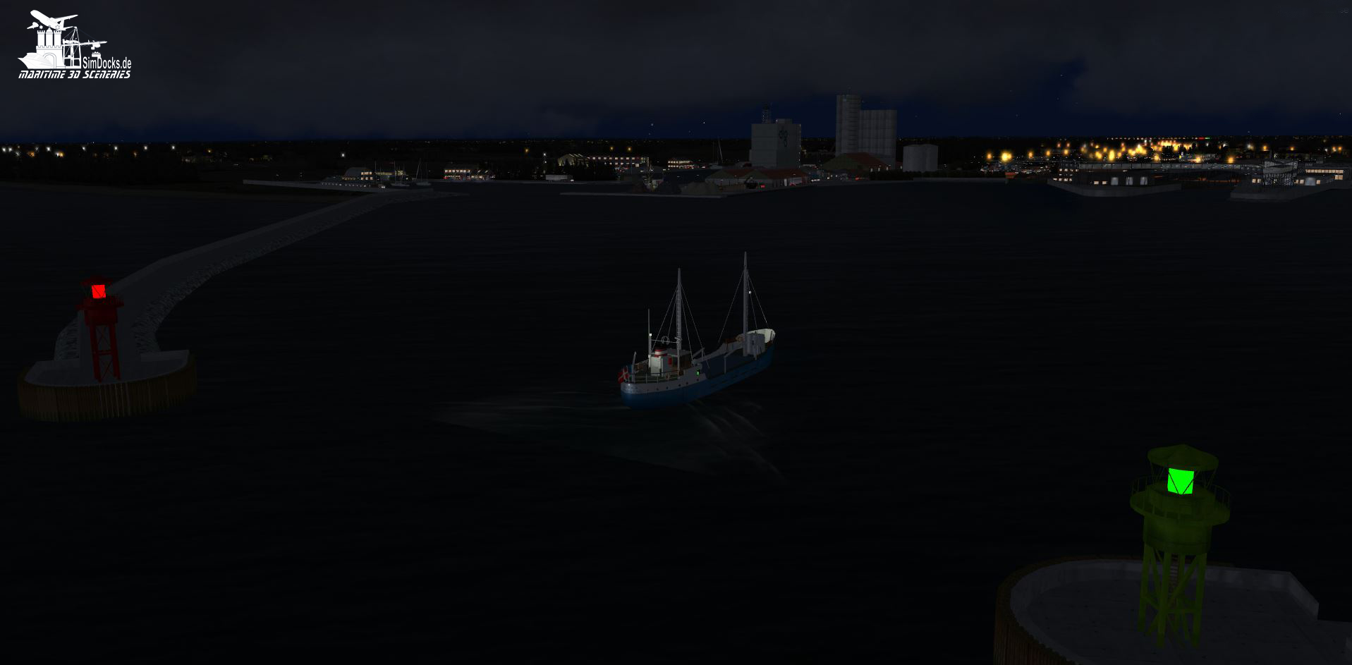
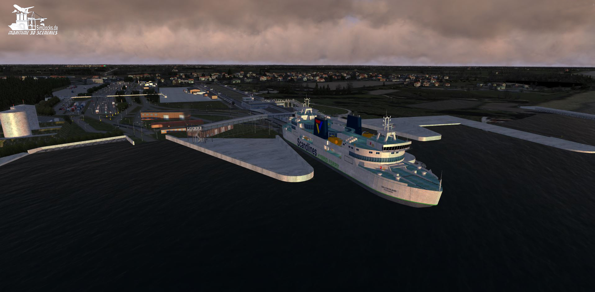
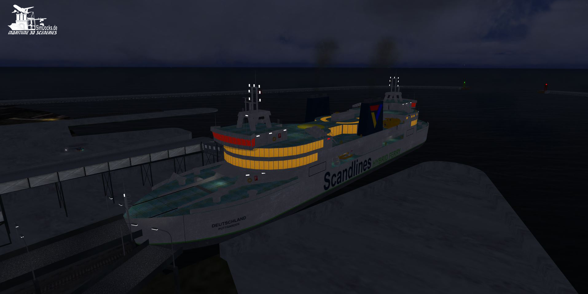
The dam with the bridges over the Europe Street 47 and the railway facilities has also been completed and is already in the scenery.

Rodby_Bodenbild-Brueckendamm.JPG


Here are two more overviews of the current state of development from south to north by day and by night.

Rodby_Bodenbild-2.JPG


Rodby_Bodenbild-Night.JPG


That's it for now. I will continue to keep you informed.
 
Is the traffic on the motorway P3Dv4 standard? If so, you might want to adjust the vector lines a bit. At the moment, one lane drives on the divider, one drives the wrong way, one correctly and one on the side strip. Police would have a field day!
 
Thats the default traffic of ORBX Vector. Hence the left-hand traffic.
I need to see if I can exclude it and replace it with new traffic.
 
I need to see if I can exclude it and replace it with new traffic.

There is a traffic exclusion landclass type. If you put it above the ORBX scenery in the scenery hierarchy and below new vector lines for traffic, you should be able to create new road traffic.
 
Hello, Bjoern,
Yeah, I know. Thanks for the tip anyway. However, I will only take care of ground traffic at the very end. First, all buildings have to be completed and the vegetation has to be planted for the different seasons. Then the details such as the small static objects and the traffic are added.
 
Now the last update concerning "Vogelfluglinie" (Birds fly route) is already 2 months ago.
In the meantime the scenery has developed slowly, but nevertheless.

The second pair of ferries, the "Prins Richard" and the "Prinsesse Benedikte" now also run between Puttgarden and Rodbyhavn.

In the past weeks I have placed thousands of trees by hand for spring/summer and autumn. Every tree and every hedge stands where they belong according to the aerial photograph.

Next on the "Todo List" is the winter vegetation.


Prinsesse Benedikte Ferry
14_05_18_Benedikte.JPG


Rodbyhaven in spring
14_05_18_Spring.JPG


Rodbyhavn in fall
14_05_18_Herbst.JPG


Rodbyhaven gardens in spring
14_05_18_Fruehlingshecken.JPG


and gardens in fall.
14_05_18_Herbsthecken.JPG
 
Last edited:
Now that the work on Rodbyhaven has been completed, the port of Puttgarden is under construction. Most of the buildings are already finished, so I can start placing the seasonal vegetation soon.
Here are some pictures of the current state of the scenery.

The Skywalk from the station to the ferries:

Puttgarden_23_06_2018-1.JPG


Puttgarden_23_06_2018-2.JPG


The railway station of Puttgarden with the ferry piers:

Puttgarden_23_06_2018-3.JPG


The wooden pedestrian bridge from the parking lots to the station and the ferry piers:

Puttgarden_23_06_2018-4.JPG


Sewage treatment plant for disposal of ship waste water:

Puttgarden_23_06_2018-5.JPG


The hotel "Dania" shortly before the ferry terminals (here a picture of the original building):

Puttgarden_23_06_2018-6.JPG


View from the south to the terminals:

Puttgarden_23_06_2018-7.JPG


Two more pictures in the dark:

Puttgarden_25_05_2018-2.JPG


Puttgarden_25_05_2018.JPG


Well, and then there's another news:
Until the end of this month I want to release a new AI ship as freeware. It is the river cruise ship "River Star" which is to contribute something to the revival of the European rivers. So far, routes on the river Elbe, the Rhine, the Moselle and the Danube are planned.
If I make it in time, it will also be routes on rivers in France, the Netherlands, Spain and...... If I don't make it, these routes will be delivered later.

RiverStar1.JPG
 
That's extraterrestrial, Manfred! Awesome work and detailed without competition! Keep on doing this outstanding work!
 
Back
Top