I do not get it either, sorry. I have not ever had this problem.
What is this alpha for water for? You already have the photoreal water blended out by the blend mask.
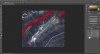
What I mean by converting to grey scale is that you take your summer texture, convert it to grey scale and then invert the remaining white, greyish and black colors left.
Do you want the water to stay water in winter or do you want to turn it into ice?
This is my .inf file for Lake Lola/Lac Lola in Quebec:
[Source]
Type = MultiSource
NumberOfSources = 8
[Source1]
Type = BMP
Layer = Imagery
SourceDir = D:\FSZIP\utilities\FSEarthTiles\work\LacLola
SourceFile = Area_Lp1_SnapOff_N045444092_N045435607_W076111395_W076095856HIWIW.bmp
Lon = -76.1872100830078 ;for top left and bottom right is: -76.1662530899048
Lat = 45.7447099685669 ;for top left and bottom right is: 45.7322323322296
NumOfCellsPerLine = 1465 ;Pixel is not used in FSX
NumOfLines = 1163 ;Pixel is not used in FSX
CellXdimensionDeg = 1.43051147460938E-05
CellYdimensionDeg = 1.07288360595703E-05
PixelIsPoint = 0
SamplingMethod = Gaussian
Variation = January,February,March,November,December
Channel_Blendmask = 8.0
[Source2]
Type = BMP
Layer = Imagery
SourceDir = D:\FSZIP\utilities\FSEarthTiles\work\LacLola
SourceFile = Area_Lp1_SnapOff_N045444092_N045435607_W076111395_W076095856coladj.bmp
Lon = -76.1872100830078 ;for top left and bottom right is: -76.1662530899048
Lat = 45.7447099685669 ;for top left and bottom right is: 45.7322323322296
NumOfCellsPerLine = 1465 ;Pixel is not used in FSX
NumOfLines = 1163 ;Pixel is not used in FSX
CellXdimensionDeg = 1.43051147460938E-05
CellYdimensionDeg = 1.07288360595703E-05
PixelIsPoint = 0
SamplingMethod = Gaussian
Variation = May,June,July,August
Channel_Blendmask = 7.0
Channel_LandWaterMask = 6.0
[Source3]
Type = BMP
Layer = Imagery
SourceDir = D:\FSZIP\utilities\FSEarthTiles\work\LacLola
SourceFile = CYP4photospringfall.bmp
Lon = -76.1872100830078 ;for top left and bottom right is: -76.1662530899048
Lat = 45.7447099685669 ;for top left and bottom right is: 45.7322323322296
NumOfCellsPerLine = 1465 ;Pixel is not used in FSX
NumOfLines = 1163 ;Pixel is not used in FSX
CellXdimensionDeg = 1.43051147460938E-05
CellYdimensionDeg = 1.07288360595703E-05
PixelIsPoint = 0
SamplingMethod = Gaussian
Variation = April,September
Channel_Blendmask = 7.0
Channel_LandWaterMask = 6.0
[Source4]
Type = BMP
Layer = Imagery
SourceDir = D:\FSZIP\utilities\FSEarthTiles\work\LacLola
SourceFile = CYP4october.bmp
Lon = -76.1872100830078 ;for top left and bottom right is: -76.1662530899048
Lat = 45.7447099685669 ;for top left and bottom right is: 45.7322323322296
NumOfCellsPerLine = 1465 ;Pixel is not used in FSX
NumOfLines = 1163 ;Pixel is not used in FSX
CellXdimensionDeg = 1.43051147460938E-05
CellYdimensionDeg = 1.07288360595703E-05
PixelIsPoint = 0
SamplingMethod = Gaussian
Variation = October
Channel_Blendmask = 7.0
Channel_LandWaterMask = 6.0
[Source5]
Type = BMP
Layer = Imagery
SourceDir = D:\FSZIP\utilities\FSEarthTiles\work\LacLola
SourceFile = Area_Lp1_SnapOff_N045444092_N045435607_W076111395_W076095856coladjnight.bmp
Lon = -76.1872100830078 ;for top left and bottom right is: -76.1662530899048
Lat = 45.7447099685669 ;for top left and bottom right is: 45.7322323322296
NumOfCellsPerLine = 1465 ;Pixel is not used in FSX
NumOfLines = 1163 ;Pixel is not used in FSX
CellXdimensionDeg = 1.43051147460938E-05
CellYdimensionDeg = 1.07288360595703E-05
PixelIsPoint = 0
SamplingMethod = Gaussian
Variation = Night
Channel_Blendmask = 7.0
Channel_LandWaterMask = 6.0
[Source6]
Type = TIFF
Layer = None
SourceDir = D:\FSZIP\utilities\FSEarthTiles\work\LacLola
SourceFile = Area_Lp1_SnapOff_N045444092_N045435607_W076111395_W076095856water2.tif
Lon = -76.1872100830078 ;for top left and bottom right is: -76.1662530899048
Lat = 45.7447099685669 ;for top left and bottom right is: 45.7322323322296
NumOfCellsPerLine = 1465 ;Pixel is not used in FSX
NumOfLines = 1163 ;Pixel is not used in FSX
CellXdimensionDeg = 1.43051147460938E-05
CellYdimensionDeg = 1.07288360595703E-05
PixelIsPoint = 0
SamplingMethod = Gaussian
[Source7]
Type = TIFF
Layer = None
SourceDir = D:\FSZIP\utilities\FSEarthTiles\work\LacLola
SourceFile = Area_Lp1_SnapOff_N045444092_N045435607_W076111395_W076095856blendtest.tif
Lon = -76.1872100830078 ;for top left and bottom right is: -76.1662530899048
Lat = 45.7447099685669 ;for top left and bottom right is: 45.7322323322296
NumOfCellsPerLine = 1465 ;Pixel is not used in FSX
NumOfLines = 1163 ;Pixel is not used in FSX
CellXdimensionDeg = 1.43051147460938E-05
CellYdimensionDeg = 1.07288360595703E-05
PixelIsPoint = 0
SamplingMethod = Gaussian
Variation = April,May,June,July,August,September,October
[Source8]
Type = TIFF
Layer = None
SourceDir = D:\FSZIP\utilities\FSEarthTiles\work\LacLola
SourceFile = Area_Lp1_SnapOff_N045444092_N045435607_W076111395_W076095856blend2.tif
Lon = -76.1872100830078 ;for top left and bottom right is: -76.1662530899048
Lat = 45.7447099685669 ;for top left and bottom right is: 45.7322323322296
NumOfCellsPerLine = 1465 ;Pixel is not used in FSX
NumOfLines = 1163 ;Pixel is not used in FSX
CellXdimensionDeg = 1.43051147460938E-05
CellYdimensionDeg = 1.07288360595703E-05
PixelIsPoint = 0
SamplingMethod = Gaussian
Variation = January,February,March,November,December
Please note that I use two different blend masks and a watermask.
Hope it helps.