Where did this information come from? I am not aware of it
Do you mean finding the four bytes or changing them - also it is very bad practice to edit APX files and if they get updated during and update then your changes will be lost.
I am the source of that information,
Currently In MSFS, every localizer at every airport, is set to the exact runway heading. This is not a problem for the great majority of localizers that actually
are aligned to the runway centerline, but causes major problems if the real world localizer is offset for operational or safety reasons. The lat/lon coordinates for the antenna arrays are correctly defined in the airport scenery. For example: the localizer antenna for runway 22R at KJFK is physically located to the left of the runway, just south of the intersection of runway 13R/31L. The localizer was placed here, because the normal location for a localizer antenna for 22R, immediately beyond the threshold of the opposite end (04L), would have required building the antenna on protected wetlands in Jamaica Bay.
In the sim, if you land on 22R at KJFK and taxi past the runway 13R/31L intersection, you will see the localizer array on the left side of the runway, exactly where it is located at the real airport.
As a result, the ILS22R localizer is offset by 2.5 degrees. Its course is 221 degrees (magnetic), while the runway centerline is 223.6 degrees magnetic.
In r/w operations, an aircraft flying this approach, tracking the localizer, will approach the runway at a 2.5 degree angle from the right side of the runway. The offset localizer will cross the runway centerline at a location in space where the glide slope MDA is located. Obviously, if the weather conditions are above ILS minimums, an arriving pilot can adjust his heading at any time prior to MDA to align with the centerline visually.
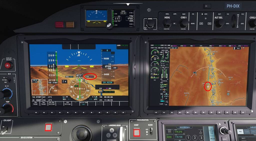
However, in MSFS this does not happen. Unlike other sims, in MSFS the Nav radio automatically sets the CDI course to the localizer course contained in the nav data file as soon as the ILS is within range and being received. (At least this is the case with all default aircraft). You cannot manually adjust the course once the ILS is being received. Of course in the case of a localizer, the path the aircraft follows is based only on its spatial position in relation to the localizer beam. As long as the CDI is kept centered, the aircraft will track the localizer correctly no matter how the OBS or digital course it set.
In the case of KJFK ILS22R in MSFS, the course auto-displayed on the PFD will be 223 degrees (the same as the runway). Indeed, the localizer
is set to 223 degrees, because if you track it inbound with a centered CDI, the aircraft will align parallel to the left side on the runway, and if left to its own devices, would land on the grass. This is due to the fact that the localizer antenna is correctly placed, but the localizer course is wrong.
I know that often, when an ILS takes you “into the grass”, it’s because the localizer antenna is placed incorrectly in the scenery, but in this case, it is in exactly the right place.
The same situation exists with all approaches with offset localizers.
The most egregious example of how bad this can be is with the two LDA approaches to runway 19 at KDCA, which are offset almost 40 degrees from the runway centerline. The runway heading is 186.3 degrees. The LDA Y 19 approach I-ASO (109.9) localizer is set to 149 degrees. The LDA Z 19 approach I-VWH (108.5) is set to 147 degrees. In both cases, the offsets exist to keep arriving aircraft west of the Potomac, and out of the prohibited airspace over the Capitol, White House and Pentagon.
In default MSFS, both of these LDA approaches have localizers set to the exact runway centerline, 186 degrees, and flying either one will bring the aircraft directly through the very prohibited airspace that is supposed to be avoided.
In the case of KDCA, the localizers are defined in the file: Official/OneStore/fs-base-nav/scenery/0302/NAX27180.bgl. This is the default Nav Blue data. BGL View can read this file, and it does indeed show (under QMID 9,109,72) that both localizers are set to the runway heading of 186.5 degrees instead of the correct 149 and 147 degrees.
Either NavBlue has been instructed to set all localizers to exact runway heading, or Asobo does it themselves when post-processing the NavBlue source data as part of the process of converting it to NAXxxxxx.bgl format.
Now, the new Navigraph beta nav data partially corrects this problem. The Navigraph data in the Community folder overrides the NavBlue default NAX file. With Navigraph installed, if I tune the LDA Y 19 approach on 109.9, the PFD course is automatically set to the correct 149 degrees. Tuning the LDA Z approach on 108.5 will set the course to the correct 147 degrees.
BUT, in the case of the LDA Y, the localizer itself is still stubbornly set to186 degrees, and tracking it in flight with a centered CDI will still bring the aircraft directly through the prohibited airspace, directly aligned with the runway centerline. Interestingly, with Navigraph installed, the LDA Z approach works correctly.
Here’s why: The “thing” causing a localizer to take the exact runway heading is the 4 byte runway-ILS link contained in the 0xCE runway record in the airport APX file. (Thank you to Hervé Sors for the insight as to what those bytes are).
In the case of KDCA, this file is: Official/OneStore/fs-base/scenery/0302/APX27180.bgl
As you undoubtedly know, this link consists of the ILS identifier numerically encoded as a 4 byte integer.
In the case of the KDCA LDA Y approach (I-ASO) if I “break the link” by editing the APX file with a hex editor to change each of the four bytes to 0x00, the forced localizer-to-runway-heading “bug” goes away, the LDA Y localizer in-game assumes the correct course of 149 degrees, and tracking it in flight brings the aircraft over the correct ground path west of the Potomac.
I have verified that any offset localizer in the sim can be made to work correctly, by overriding the default nav data with Navigraph, and zeroing out the ILS-runway link in the associated APX file. In the case of a custom airport like KJFK, it also requires editing the custom APX file the same way.
Though this “works”, it is obviously not a recommended procedure, as one should not be directly edit default APX bgl files.
The KDCA LDA Z approach works correctly with only Navigraph present (no APX edit required), because as you know, there can be only one ILS linked to a specific runway, and in the case of KDCA the link is attached to the LDA Y approach. Since the LDA Z approach has no link to runway 19, it works correctly with just Navigraph installed. You could get the same result (without Navigraph) by editing the default NAX file to change the float value for LDA Z from the incorrect 186.5 to the correct 147.0.
Conclusions:
In default MSFS, every runway localizer is set to the exact runway heading in the associated NAX file. It is either being supplied that way by NavBlue, or post-edited by Asobo.
Even with a correct localizer definition supplied by Navigraph beta nav data, it makes no difference, because if an ILS-runway link exists in the airport APX file, the presence of that link forces the localizer to the runway heading
no matter what the nav data file value is. If the link is disabled by changing the four bytes to 0x00, then the localizer will take whatever course is defined in the nav data.
This was obviously a deliberate design choice by Asobo. The fact that every localizer in the default NAX files is set to the exact runway heading (rather than the correct published course), makes this clear. It’s fine for the majority of ILS approaches in the sim, but very wrong for localizers that are offset - especially when the offset is substantial as is the case with the two LDA approaches at KDCA.
It occurs to me that this behavior may actually be encoded into the default Nav receiver emulation - i.e. if the receiver “sees” the ILS-runway link in the APX file, then it ignores the nav data localizer definition and “sees” the localizer as being aligned with the runway centerline. Without the presence of the link, it ”sees“ the localizer as defined in the nav data. Of course without Navigraph, the nav data will always be wrong where offset or LDA approaches are concerned.
That’s all I’ve got to say about that. Expert insights very welcome, but there are some questions about this situation that only Asobo could answer,