- Messages
- 217
- Country

Hello again, already fixed the previous problem, but I have another problem with the mesh
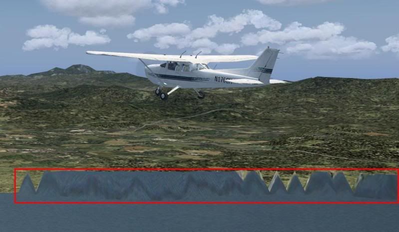

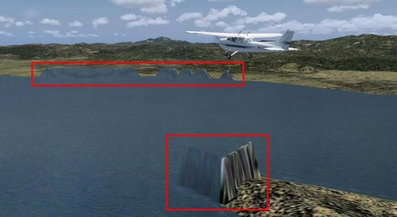

It's very rare, It's fixed when used the altered file in the "Flight Simulator 9\Scenery\Same\scenery" directory, but when restored the original file in the same directory I got those rare elevations
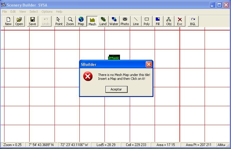
Here is what I did in SBuilder

Help please
It's very rare, It's fixed when used the altered file in the "Flight Simulator 9\Scenery\Same\scenery" directory, but when restored the original file in the same directory I got those rare elevations
Here is what I did in SBuilder
Help please


 this is what I did:
 )
)")


 in this case I made the Mesh by converting 2 GeoTiff files (downloaded from