
- Messages
- 41
- Country


Does anyone know how to remove the spikes which are seen here clearly on the top of a cliff? I am aware that they are caused by over-sampled mesh, but i want to remove them without having to lower the LOD.

Any other question that is not specific to an aspect of development or tool can be posted in the General chat forum.
By following these guidelines we make sure that the forums remain easy to read for everybody and also that the right people can find your post to answer it.


Does anyone know how to remove the spikes which are seen here clearly on the top of a cliff? I am aware that they are caused by over-sampled mesh, but i want to remove them without having to lower the LOD.


"* What was the horizontal and vertical resolution of the custom terrain mesh DEM source data ?"
Hi GaryGB,
Here are the answers to the questions you requested above in the correct order.
* 1916 x 934


 ;
;


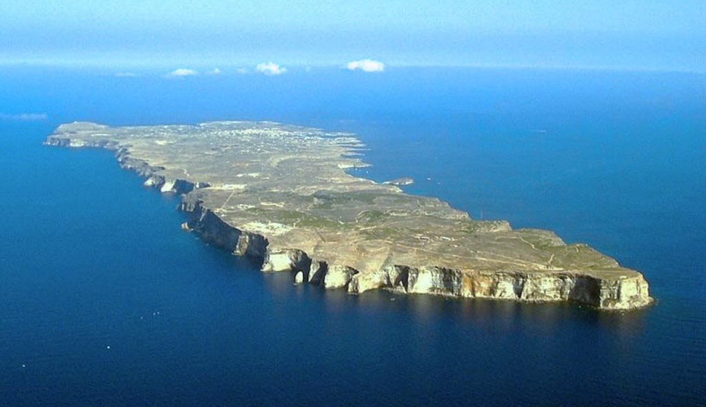

For the main island of Lampedusa, as seen below, i have not excluded the default water polygons.
In the mean time, I'd like to initially ask, when you created the polygon (seen as a "selected" green line with vertex points defining the coastline) in your 2 SBuilderX screenshots above, what BGL output type was it intended to be ?
The Polygon was created a while back ( 3-4 weeks ago),BGL output intended was one and it was of a Terrain Vector type.


the terrain mesh was declared to be "5 Meter" resolution, but IMHO was clearly no better than 90 Meter (or at best, 76 Meter) source data resolution as far as actual terrain "shape" detail seen in FSX at run time, or viewed in FSX SDK TMFViewer.


When i add the coastline polygons over the DEM it actually cuts through the elevation data causing the spikes, if i extend the polygons out in to sea the problem disappears.
AFAIK, this is what was done in the Playsims Publishing VFR Photographic Scenery Generation X - Volume 8 Scotland South for FSX; the terrain mesh was declared to be "5 Meter" resolution, but IMHO was clearly no better than 90 Meter (or at best, 76 Meter) source data resolution as far as actual terrain "shape" detail seen in FSX at run time, or viewed in FSX SDK TMFViewer.
However, the higher grid resolution of terrain mesh vertices enabled by the 5 meter mesh in that add-on scenery package were made available for whoever wished to implement higher resolution vector flattens for terrain correction.
I don't know where you get your facts.

When you made your polygon in SBuilderX which sat service were you using? If Google Earth, there may be a slight offset. As to why, I dunno, but I did some comparing a good while back for things like airports and using a GE background to do airport work and then putting the airport on top of photo scenery would show a slight difference. If I had used a MS Virtual Earth/Bing?whatever they call it nowadays background, then the airport would align with the photo scenery.
So I'm just saying, if you used GE don't take it as 1000% accurate.
How to create photoreal scenery for FSX - by "Tiberius K."
http://www.flightsim.com/vbfs/showthread.php?250762-How-to-create-photoreal-scenery-for-FSX

