- Messages
- 21
- Country

Thank you for the help and useful information and also your patience. And the encouragement at the last post was so much appreciated ")
I have now made a new version and replaced the old link. And it can be downloaded from here:
The main problem seemed to be the inverted tille-y naming standard from TMS / Google.
I've added an option (/y TMS | Google) so that both can be handled.
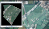
In Rumbaflappys sceenshots one can see that checkmark in the image to generate tiles, and it's named like "Use inverted tiles".
If my tool doesn' seem to handle "inverting" by the /y option one may try to export it from qgis (rumbaflappys post above) with the checkbox set.
I have reviewed a lot of different sources and tried to verify the quad-keys. I've also checked the quads from the program "TileSystemTools" from Eugen1975 and it seems to match.
But since zoom-level 20 generates quite a bit of files my testing was limited at level 20, but I have tested several of the lower levels. So I will appreciate your help on this.
My testing har been primarily at TMS tiles so it will be good to get your feedback on the google-style numberings. And if those are usable by the SDK.
The tool at https://www.maptiler.com/google-maps-coordinates-tile-bounds-projection/ was also used in my testing, and may be useful to others too....
I have now made a new version and replaced the old link. And it can be downloaded from here:
The main problem seemed to be the inverted tille-y naming standard from TMS / Google.
I've added an option (/y TMS | Google) so that both can be handled.
In Rumbaflappys sceenshots one can see that checkmark in the image to generate tiles, and it's named like "Use inverted tiles".
If my tool doesn' seem to handle "inverting" by the /y option one may try to export it from qgis (rumbaflappys post above) with the checkbox set.
I have reviewed a lot of different sources and tried to verify the quad-keys. I've also checked the quads from the program "TileSystemTools" from Eugen1975 and it seems to match.
But since zoom-level 20 generates quite a bit of files my testing was limited at level 20, but I have tested several of the lower levels. So I will appreciate your help on this.
My testing har been primarily at TMS tiles so it will be good to get your feedback on the google-style numberings. And if those are usable by the SDK.
The tool at https://www.maptiler.com/google-maps-coordinates-tile-bounds-projection/ was also used in my testing, and may be useful to others too....